Map
The map UI component displays a geographic map. The default map data is provided by the OpenStreetMap project. For more information, see the Map API.
This feature is optional.
Basic Usage
To use a map component in your application:
-
Add a map with
elm_map_add()function:Evas_Object *map; Evas_Object *parent; map = elm_map_add(parent); -
Set the zoom mode with the
elm_map_zoom_mode_set()function:elm_map_zoom_mode_set(map, ELM_MAP_ZOOM_MODE_MANUAL); -
Set the zoom level with the
elm_map_zoom_set()function:elm_map_zoom_set(map, 12); -
Show a specific area on the map based on coordinates using the
elm_map_region_show()function:elm_map_region_show(map, 2.2, 48.8);To show a specific area with a bring-in animation, use the
elm_map_region_bring_in()function:elm_map_region_bring_in(map, 2.2, 48.8); -
Register the callback functions.
The following example shows how to define and register a callback for the
clickedsignal:evas_object_smart_callback_add(map, "clicked", clicked_cb, data); void clicked_cb(void *data, Evas_Object *obj, void *event_info) { dlog_print(DLOG_INFO, LOG_TAG, "Map clicked\n"); }
The following example shows a simple use case of the map component.
Example: Map use case

Evas_Object *win;
Evas_Object *conf;
Evas_Object *nf;
Evas_Object *box;
Evas_Object *map;

/* Starting right after the basic EFL UI layout code */
/* win - conformant - naviframe */

/* Add a box to contain a map and push the box into the naviframe */
box = elm_box_add(nf);
evas_object_show(box);
elm_naviframe_item_push(nf, "Map", NULL, NULL, box, NULL);

/* Add a map */
map = elm_map_add(box);
evas_object_size_hint_align_set(map, EVAS_HINT_FILL, EVAS_HINT_FILL);
evas_object_size_hint_weight_set(map, EVAS_HINT_EXPAND, EVAS_HINT_EXPAND);

/* Set zoom mode to manual and zoom level to 12 */
elm_map_zoom_mode_set(map, ELM_MAP_ZOOM_MODE_MANUAL);
elm_map_zoom_set(map, 12);

/* Show a region (2.2 N, 48.8 E) */
elm_map_region_show(map, 2.2, 48.8);

evas_object_show(map);
elm_box_pack_end(box, map);
Styles
The following table lists the available component styles.
Table: Map styles
| Style | Sample |
|---|---|
default |
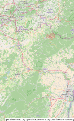 |
Callbacks
You can register callback functions connected to the following signals for a map object.
Table: Map callback signals
| Signal | Description | event_info |
|---|---|---|
clicked |
The map is clicked without dragging. | Evas_Event_Mouse_Up |
clicked,double |
The map is double-clicked. | Evas_Event_Mouse_Down |
press |
The map is pressed down on. | Evas_Event_Mouse_Down |
longpressed |
The map is pressed down for a long time without dragging. | Evas_Event_Mouse_Down |
scroll |
The content is scrolled (moved). | NULL |
scroll,drag,start |
Dragging the content starts. | NULL |
scroll,drag,stop |
Dragging the content stops. | NULL |
scroll,anim,start |
The scrolling animation starts. | NULL |
scroll,anim,stop |
The scrolling animation stops. | NULL |
zoom,start |
The zoom animation starts. | NULL |
zoom,stop |
The zoom animation stops. | NULL |
zoom,change |
The zoom is changed when using an auto zoom mode. | NULL |
tile,load |
The map tile image load begins. | NULL |
tile,loaded |
The map tile image load ends. | NULL |
tile,loaded,fail |
The map tile image load fails. | NULL |
route,load |
The route request begins. | Elm_Map_Route |
route,loaded |
The route request ends. | NULL |
route,loaded,fail |
The route request fails. | NULL |
name,load |
The name request begins. | Elm_Map_Name |
name,loaded |
The name request ends. | NULL |
name,loaded,fail |
The name request fails. | NULL |
overlay,clicked |
An overlay is clicked. | Elm_Map_Overlay |
loaded |
The map is loaded. | NULL |
Note
The signal list in the API reference can be more extensive, but only the above signals are actually supported in Tizen.
Note
Except as noted, this content is licensed under LGPLv2.1+.
Related Information
- Dependencies
- Since Tizen 2.4